
America@250: Redlining, Racial Covenants, and Segregated Suburbs


“The biggest segregation of all that overwhelms everything else and hangs over our entire society is that every metropolitan area in this country is residentially segregated. I’ve lived in many of them. And there are clearly defined areas in each one that I’ve lived in; they are all white or mostly white or all African American and mostly African American. All of us accept this as part of the natural environment.
“It’s not.
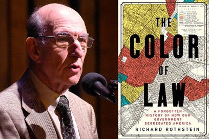
“We’ve adopted a national myth called de facto segregation. There is no basis to it whatsoever.
The racial segregation in every metropolitan area in this country was created by explicit racially explicit government policy designed to create racial boundaries to ensure that African Americans and whites could not live near one another with policies that are so powerful that they still determine the racial landscape that we see in cities all over the country.”
◊ ◊ ◊

The origins of the term, redlining, come from government homeownership programs that were created as part of the 1930s-era New Deal. The programs offered government-insured mortgages for homeowners — a form of federal aid designed to stave off a massive wave of foreclosures in the wake of the Depression.

As these programs evolved, the government added parameters for appraising and vetting properties and homeowners who would qualify. They used color-coded maps ranking the loan worthiness of neighborhoods in more than 200 cities and towns across the United States.
Neighborhoods were ranked from least risky to most risky — or from “A” through “D.” The federal government deemed “D” areas as places where property values were most likely to go down, and the areas were marked in red — a sign that these neighborhoods were not worthy of inclusion in homeownership and lending programs. Not coincidentally, most of the “D” areas were neighborhoods where Black residents lived.
◊ ◊ ◊
Racial Covenants
Serving as legally-enforceable contracts, racial covenants can be found in the property records of every American community. These restrictive clauses were inserted into property deeds to prevent people who were not White from buying or occupying land.
A survey of the 30,000 covenants unearthed in Hennepin and Ramsey Counties illuminates the wide variety of people targeted. An early Minneapolis restriction proclaimed that the “premises shall not at any time be conveyed, mortgaged or leased to any person or persons of Chinese, Japanese, Moorish, Turkish, Negro, Mongolian or African blood or descent.” Before 1919, Jews were often included in this laundry list of “objectionable” people.
◊ ◊ ◊

Kyona and Kenneth Zak found a racial covenant in the deed to their house in San Diego that barred anyone “other than the White or Caucasian race” from owning the home. Although now illegal across the country, the covenant would have prevented Ms. Zak, who is Black, from owning the home. Photo credit: John Francis Peters for The New York Times
In 2020 to celebrate the centennial of their Craftsman home, Kyona and Kenneth Zak repainted it in historically accurate colors — gray, bronze green and copper red. They commissioned beveled-glass windows to complement the original stained glass.

And they visited the San Diego County Recorder, to have a line drawn through a sentence in their deed that once would have prohibited Ms. Zak, who is Black, from owning the home.
Roadways

Cars on the Southern State Parkway in Nassau County, circa 1960. The urban planner Robert Moses, according to biographers, designed the road so that bridges were low enough to keep buses — which would likely be carrying poor minorities — from passing underneath on the route from New York City to Long Island’s beaches. Pictorial Parade/Getty Images
When the urban planner Robert Moses began building projects in New York during the 1920s, he bulldozed Black and Latino homes to make way for parks and built highways through the middle of minority neighborhoods. According to one biography, Moses even made sure bridges on the parkways connecting New York City to beaches in Long Island were low enough to keep city buses — which would likely be carrying poor minorities — from passing underneath.
But Moses was no outlier. The highways and public spaces that shape our cities were often intentionally built at the expense of Black, Latino and other minority Americans.
◊ ◊ ◊
Suburbs

Videos
◊ ◊ ◊
◊ ◊ ◊


